
Upper Clyde Trout and Grayling Fishing
This page will cover what most people would refer to as the Upper Clyde, from near its source deep in the Lowther Hills, at what is now the Daer Reservoir to around Blantyre, South of Glasgow. Below
To see which sections are covered by Mid Clyde, have a look at this Google Map with the Mid Clyde Pools clearly designated.
Protection Order
The Clyde system is covered by a Protection Order and so you cannot venture onto the river without a permit.
Permits are available for Migratory fish ( Salmon and Sea trout) and non migratory fresh water species.
Salmon and Sea Trout run as far as the Stonebyres Weir though you will hear of salmon trying to climb the Falls of Clyde at Lanark which is a very definite insurmountable barrier to the fish. It’s non migratory fishing only above this point
The river is divided up between a number of different angling associations, clubs and bodies.
Rules on methods vary but in general fly, lure and bait fishing are allowed. Bait methods may be restricted i.e. I know ledgering is not allowed on UCAPA water.
Depending which section you want to fish you will need to check who runs it, where you can get permits, and what days fishing is allowed, as it varies. None of this is particularly helpful to the angler, and one wonders what’s stopping them running some sort of passport scheme like they have in some systems in England and Wales, so you can go onto any water under a single ticket or block of tickets that you use up.
Species
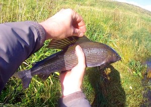
In the upper Clyde above the New Lanark Weir the main target species is Brown Trout. These are now entirely wild or at worst, naturalised fish. There is no longer any stocking taking place. Grayling are also present on the upper Clyde having been introduced to the river in the 19th Century. The Trout Season is the traditional 15th March to 6th October practiced in most river systems.
River Clyde Brown Trout
River Clyde Brown trout are now being caught to some very considerable size. Certainly the River Clyde is a river for the specimen hunter. Every season fish in excess of 4lb are caught and there are tales of bigger.
These fish can be very hard to catch, when located, and locating them first is no mean feat, these fish are wary, and long lived in the River and do not get fooled easily. However fish at the right time of day in the right sections and the patient angler will be rewarded with a fish of a lifetime.
The Brown Trout Season is 15th March to 6th October. While fish may be taken for the pot most anglers fish catch and release and it tends to only be injured fish that are taken. Legal methos are fly, trotting with worm or maggot, and spinning when the water is high enough. Barbless hooks are preferred.
Grayling Season
In Scottish legal terms, anglers can fish for Grayling and Coarse species all year round as they are considered invasive species. However in recent seasons the UCAPA section has operated a Grayling Season.
UCAPA state their Grayling season is 7th October to 14th March but how they could enforce that is a hard call- to me its a daft rule.
Lamington have a Grayling winter season that runs from the close of the trout season upto the 31st January. They then “rest” their section of river until opening on 15th March. To the best of my knowledge their is no restriction on targetting Grayling on Lamington water, but best check their website to be sure.
In all cases though invasive, Grayling are a prized game fish and close to ALL Grayling are now returned to the river, when caught. Anglers generally will not target them from opening of the Brown Trout Season, through to mid/late June, allowing the fish time to spawn and recover.
There are Barbel in the mid/lower river to some considerable size and a few are caught each year in error by salmon anglers and by keen coarse anglers happy to put in the time to locate and catch them. How they came to be in the river I have no idea, I am sure it would not be allowed now!
While “take” limits are specified by the permit issuers in all cases, as is the practice these days, Catch and Release is strongly encouraged and you should try to use Barbless, debarbed or at most, micro barbed hooks in your fishing.
Personal note: Please don’t remove the Grayling in particular, they are totally wild and will not just magically come back if wiped out, they have a hard enough time with the Cormorants on the river in winter.
Associations and Permits
There are five organisations running fishing on the upper Clyde river System.
Some of the sections are non contiguous ie. for instance UCAPA control the very upper reaches of the river, it then becomes Lamington, then UCAPA again, then Hozier then UCAPA etc. You really need to get a OS map of the area and work out who starts where. For ease of fishing, though not the cheapest, if you plan to fish the river a lot and cover a lot of ground you are probably as well to purchase season tickets for all areas and save having to worry about permits and crossing boundaries! None are especially expensive.
UCAPA ( United Clyde Angling Protective Association Ltd.)
The biggest body controlling some twenty odd miles of river. Technically I believe the fishings extend all the way from the Daer Reservoir where the Clyde rises. There were restrictions on the Clyde above Telford Bridge for a number of years due to American Signal Crayfish infestation. Steps were taken to try remove these unwelcome pests and to restrict their move down stream but the battle has been, if not lost, put on the back burner in recent years. Anglers can now access the river all the way upstream. The lower limit of the upper section is at the junction with the Roberton Water.
From the Roberton Water junction, the next 7 miles or so of river belong to LDAIA. There are a couple of restrictions inside this area so check a permit or the LDAIA website for full details. This area is entirely freshwater species only and fishing is only permitted 7 days a week in season for Trout and other species. No Sunday fishing is currently allowed. When Trout are out of season, you can still fish for Grayling or other coarse species. From the details on their website the full details of their water is as follows- please check their page for up to date info:
It is valid for parts of the Mouse, Douglas Water, Duneaton Water and the River Clyde, with the following exceptions:
- All waters upstream of Telford Bridge, Crawford.
- Southwood Farm, Abington.
- Lamington Association Stretch from Roberton Burn to Thankerton Bridge.
- Lampits Farm, Carstairs.
- Stonebyres Falls to Stonebyres Bridge (both banks) Power Station Property.
- Overton Farm, Crossford.
- Ross Estate, Hamilton.
- Motherwell Bridge to Bothwell Bridge (both banks) within Strathclyde Country Park.
The upper part above Lamington is fairly easy wading and can run very clear and low if there has been little rain, so you may need to search out the deeper lies.
Website
Lots of information but a wee bit hard to follow and a little dated looking http://www.ucapaltd.com/
Permits
Follow this link for permit issuers and this one for permit prices: For 2019 there is no Grayling Season ticket just for this winter. Day tickets are available but much better value is a Clyde Season ticket which starts on October 7th 2018 and runs until March 14th 2020 for £55.
Map
Lamington and District Angling Improvement Association
The LDAIA holds the rights for fishing on a nine mile stretch of the river, from the Bower Pool at Roberton down to the Boat Bridge , Thankerton. Fishing is restricted to the normal Trout Fishing season for Brown Trout, and there is NO SUNDAY FISHING on this section. Grayling permits are issued out of season but they stop Grayling activities through February and March.
Map
A useful map can be found on the club website. This is the same map issued to permit holders and is good enough to cross ref with an OS Map. You can also download a high res map of the Lamington Clyde from this link.
Permits
Follow this link for rules and permit issuers.
Website
Quite a nice website with clear information on the Association waters, maybe just needs more regular updates as we roll into a new season. http://www.lamingtonfishing.co.uk
Hozier Angling Association
Update 2022: It appears Hozier AA is no more. I understand the gentleman that presided over the AA either passed away or gave up the management of this section of river which is straddled by Hyndford Bridge south of Lanark and that there wasn’t any interest shown in taking it on from his associates or family. So the section is now under the control of UCAPA which makes accessing this stretch easier than it used to be, no more chasing after permits!
If you check out the UCAPA website map it is worth noting there is a stretch of the North Bank that is off limits, that looks to be about 100mtrs long but this should cause most anglers little major issue if visiting. I have screen grabbed the section of map for convenience but please refer to UCAPA for up to date information in case this should change.
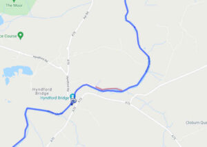
Restriction on fishing from the North bank of the former Hozier Beat
I have to be honest and say though I never knew Hozier “that” well, I don’t recall their being a restriction on access on this bank previously, so whether this is new or not I really do not know, just be aware of it. There are quite a few nice houses down her enow and I imagine it is some sort of privacy rule.
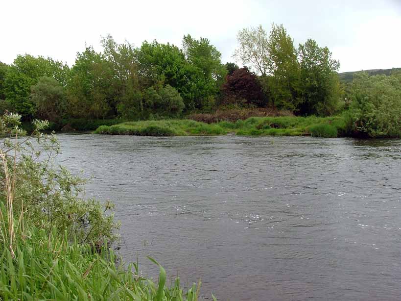
Hozier section
Map
As per UCAPA
Permits
Now covered by the standard non migratory UCAPA permit. Note, that Migratory fish do not get this far up the Clyde.
Website
As per UCAPA.
Avon Angling Association
Not the actual River Clyde but part of the Clyde river system the Avon enters the Clyde at Hamilton. The fishing is controlled by the Avon Angling Association who provide permits and stock the river over a 14 mile section. Their section contains Brown Trout (Wild and stocked) , Grayling and some Salmon and Sea trout being as it is below New Lanark. I beleive the river gets a good reputation but never having fishe dit myself can’t really tell the reader much more- worth a try though a bit of a run for me.
Map
You can download a map of the Avon Angling Associations water here.
Permits
Permits can be purchased online which is cool or from a range of outlets listed on this page.
Website
Avon Angling Association have at least made an effort and their site is clear and reasonably well laid out though the navigation is a bit difficult to spot at first- and they use Comic Sans font which is a terrible idea on the website- you won’t see that if you don’t have this font installed on your computer- think yourself lucky! http://www.theavonanglingclub.co.uk
Upper Avon Angling Association
The Upper Avon Angling Association run the top 8 miles of the Avon, from Craig Bridge on the B7086, to the source. Bank access varies so again check the permit or club website. The fishing is for Brown Trout and Grayling, with the wild Brown Trout being supplemented by stocking from in house produced genetic river stock. The river is well managed and contains a good head of Brown Trout. You can read more on this section on a page I have now created on the Upper Avon.
Map
Following my initial review UAAA contacted me and have now set up a Google Map with key points of interest marked on the map. Well done chaps! You can see the map on the River Avon page or on the UAAA website
Permits
Permits are £10 per season- yes thats not a typo! Got to be worth it if you live near hand, given a day ticket on UCAPA is £10!
Website
Again following the initial review on this site UAAA have acted very quickly (see the comments on this page) and have fully reviewed and tidied up their menus. Full credit to them thay have a cracking wee site along with a very enthusiastic organisation and are to be warmly commended. This wordpress driven site is packed with information and is by far the best of the bunch and seems to be kept up to date. http://www.upperavonangling.co.uk
It also covers fishing at Glengavel Reservoir which is also run by the club and which gets a very good write up.
All the above information is based on my understanding of the fishings and is both subject to change, error and my interpretation. There are a couple of further resources I would recommend for those interested in Clyde fishing. The River Clyde Fishing website, join the forum, the Anglers Book of the Clyde and Clydestyle Fishing, a tackle shop at Crossford near Larkhall on the Clyde. (closed Mondays). Please mention our site here if communicating with any of the above resources quoted.
Let’s Fly the Clyde
To let anglers visualise the river, when I am able I have collected drone footage of sections I have visited and posted them with the relevant section below. You can also see them all on this map.
Beats
In this section I want to cover the sections of the river, that I am familiar with and over time will add more as I learn sections.
Elvanfoot
This is in essence a very long section in the very upper reaches of the river. You can walk miles as the river gradually broadens from the outflow at the Daer Reservoir. It also meanders quite a bit and I have only fished maybe half a mile to a mile of the river here.
Wading like much of the upper river is fairly easy with lots of golf ball sized pebbles and gin clear water. It cuts through fields with some high cut banks and deep pools beneath. This section has a better reputation for Brown trout rather than Grayling water but never say never. I have heard of nice Grayling being caught up here.
Telford Bridge
Telford Brig’ is a short section that is literally steeped in history. If you are at all interested in the Bridge you need to check out the small graveyard literally at the foot of the Bridge. The Telford Bridge at Elvanfoot ( about a mile north of Elvanfoot kirk), was built under the guidance of Thomas Telford the great Scottish Engineer. Irish “navigators” or “navvies” were used to build the road and the bridge and suffered losses as they blasted through rock and worked through winter in what I imagine were pretty hard conditions.
Many of these Navvies are buried below the bridge and the area is delineated by a chain link boundary marker.
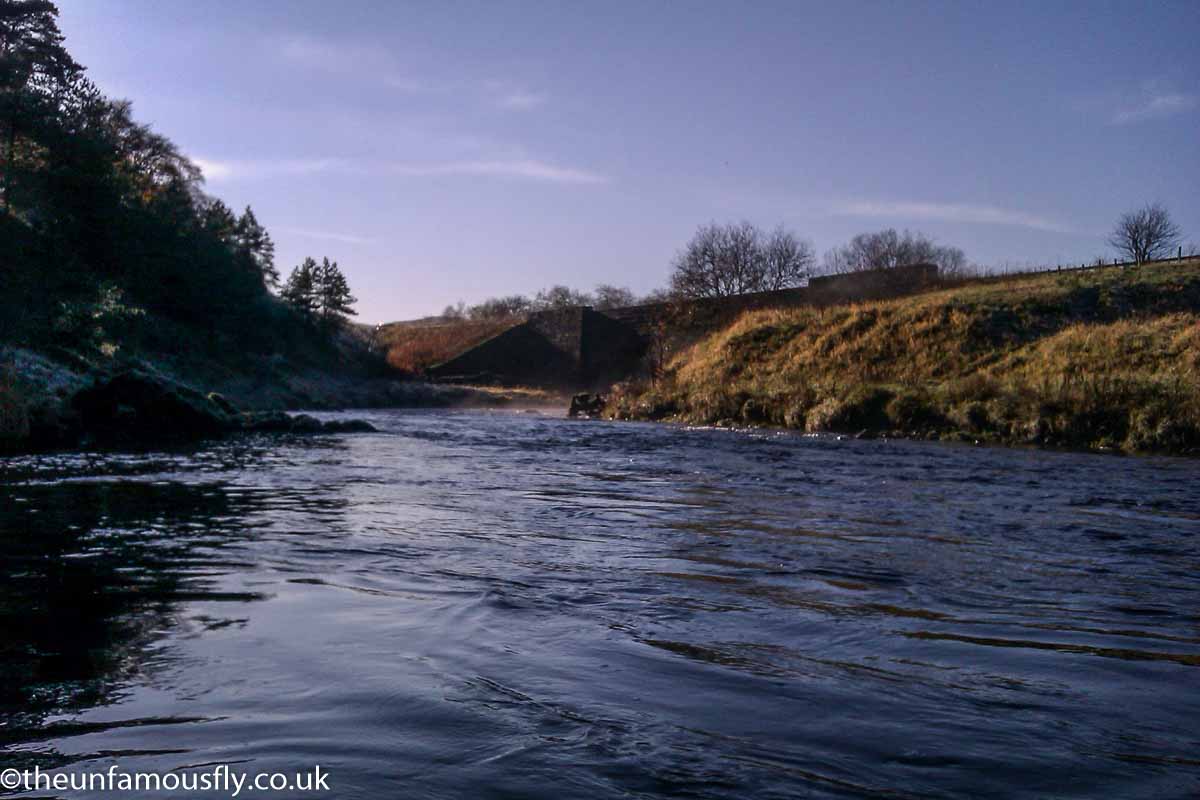
Fishing wise it is quite shallow for much of the section but there are some nice deep holes if you explore and some fast pocket water too. Downstream as it shallows out it gets more bouldery and then meanders on down towards Crawford.
Crawford
Crawford is a relatively shallow section of the river with a few deep holes which are worth seeking out. Wading is fairly easy up here and you shouldn’t encounter too many difficulties.
You can access via a get at Crawford village ( you will see the UCAPA sign) just do not obstruct access for the farmers or landowners.
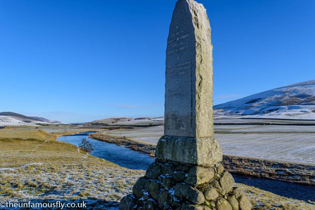
Abington (Monument)
For the purposes of review I have considered ( for now) the Abington section in two parts. It is possible this will increase in furute updates.
The river meanders slowly through flat plains and fields here and is pretty easy to access and wade. Take something like a section of foam pipe lagging as you almost certainly will need to negotiate barbed wire fences which are brutal on waders. It is certainly possible to fish all the way down to Roberton Water from here but the next section may make this easier if that is your target area.
For the most part these waters are relatively easy wading. There are many areas of relatively fine gravel. However there are a few areas which seem to be formed of particularly uneven boulders. I am not sure if these are residue from old dry stane dykes or some other excavation of rocks from the fields, but they can be a little trickier to navigate.
In general, the waters up this end of the river flow very clear most of the time and there are almost no trees or bushes to speak of that will cause you issues when casting.
Let’s Fly the Clyde: Abington Monument
Abington (Duneaton)
Heading on in a north easterly direction from Monument you will drive close to the river and after navigating a roundabout the road crosses the river. Just after this bridge you can turn hard right heading back to the riverside. If you wish you can drive down the side of fields on the left to the junction with Duneaton water, or park by the bridge and walk downstream as far as Roberton Water and the Lamington Boundary.
Lets Fly the Clyde: Abington Duneaton
Wolfclyde Bridge
Wolfclyde Bridge is possibly one of the best-known locations on the River Clyde. Just between Symington and Biggar, Wolfclyde Bridge is right in the middle of the LDAIA water. Anglers generally park either side of the road, at the bridge, from where you can work upstream or downstream. Wading downstream from the bridge is generally fairly easy and you will find some good Brown Trout and Grayling in these waters. Being above the falls at New Lanark there are no migratory fish this far up. LDAIA also do not permit competitions on their water, nor Sunday fishing. This water is fly only.
It is a lovely stretch of water and you can walk for miles from here if you have the time to explore. The further you get from the road the less pressured water you will find.
Libberton
Libberton (UCAPA) is not the easiest section to get physical access tot he water as the river runs across a broad plain of farmland that has no close by roads. However there is one field access I am awar eof that while not overtly “permitting access” doesn’t say you can’t, merely instructing people accessing, to shut the gate. On my visit the farmer was about but never bothered us. I would add though that while there were sheep about and we drove slowly in their presence, you likely would not want to enter the field if it had cows in as your car might get wrecked!
The river is broad and flat looking here but does move at a deceptively brisk pace. Wading is on the whole easy and the water was very clear when I was their, some area were much deeper than they looed at first sight. There is a deep channel in much of the section under the western bank. A noteable sharp turn at the south end is broad, flat and very deep with a big back eddy. You can just about gain access to the water here but you could not wade far, not sure about the far bank.
Lets Fly the Clyde : Libberton
Carstairs
The

You can also fish the Medwin water which enters here. Please be aware though some of the fishing on the Medwin and the Clyde here is single bank fishing.
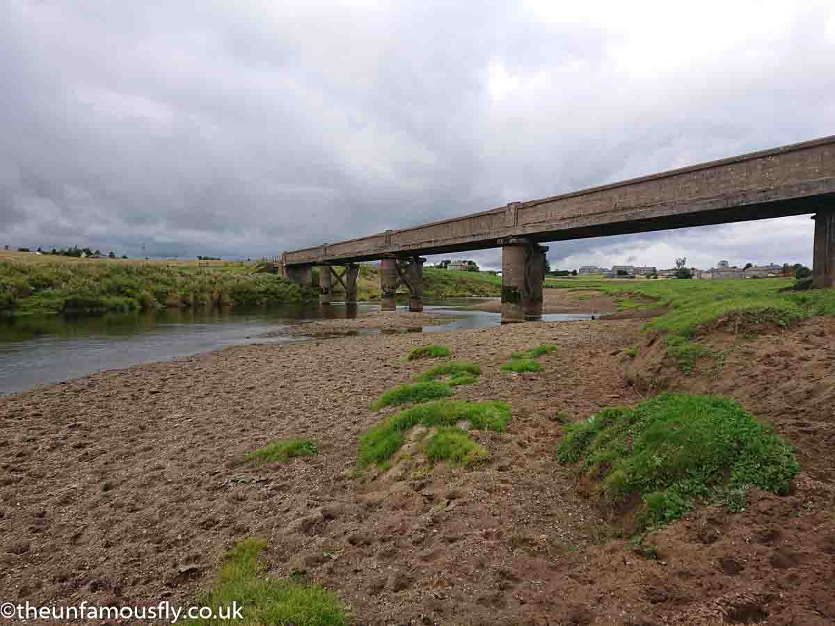
The biggest issue at Carstairs area is the wind. If it is at all breezy at normal levels, it will be blowing you off your feet up here. Note the amount of windfarms in the area.
An area to explore on still, settled weather days.
Hozier Upper ( Clyde Shoals )
Hozier is a reasonable section of the river to try to fish over a day or two. However there are quite significant differences in the water from the top of the beat to the bottom. The top of the Hozier water is a large area of bouldery rapids known as the Clyde Shoals. Wading here is not for the infirm or faint of heart. I would STRONGLY recommend use of a wading staff and life presever here. Think white water Kayaking type water amd you won’t be far away.
Let’s Fly the Clyde: Hosier Upper
Hozier
Hozier is usually accessed by parking at the Hyndford Bridge Garden Centre and crossing over to the river access by the bridge. Most of this section is fairly flat relatively easy wading water though there are some deep pools. Getting over the river therefore may be a challenge in anything above normal levels. Even at normal river levels you can wade over only at select spots.
It does though have some nice steady glides and is great for both dry fly fishing and bugging. I caught my first ever river fish on a dry fly on the Hozier water!
Clyde Valley
Hazlebank/Byres Burn

The section I know as Hazelbank is a bit of a steep gorge area of the River, and I am sure there are several ways to access this but the place I know is by the Byres Burn. There is what looks like an Estate entrance on the left side of the A72 heading north with a long run-off area. There are no markings to prevent parking so I have in the past parked at the very end of this lane. There is a wooden gate/style opposite and there is a route that leads down to the river from here, though be aware it is steep and slippy. You can’t though
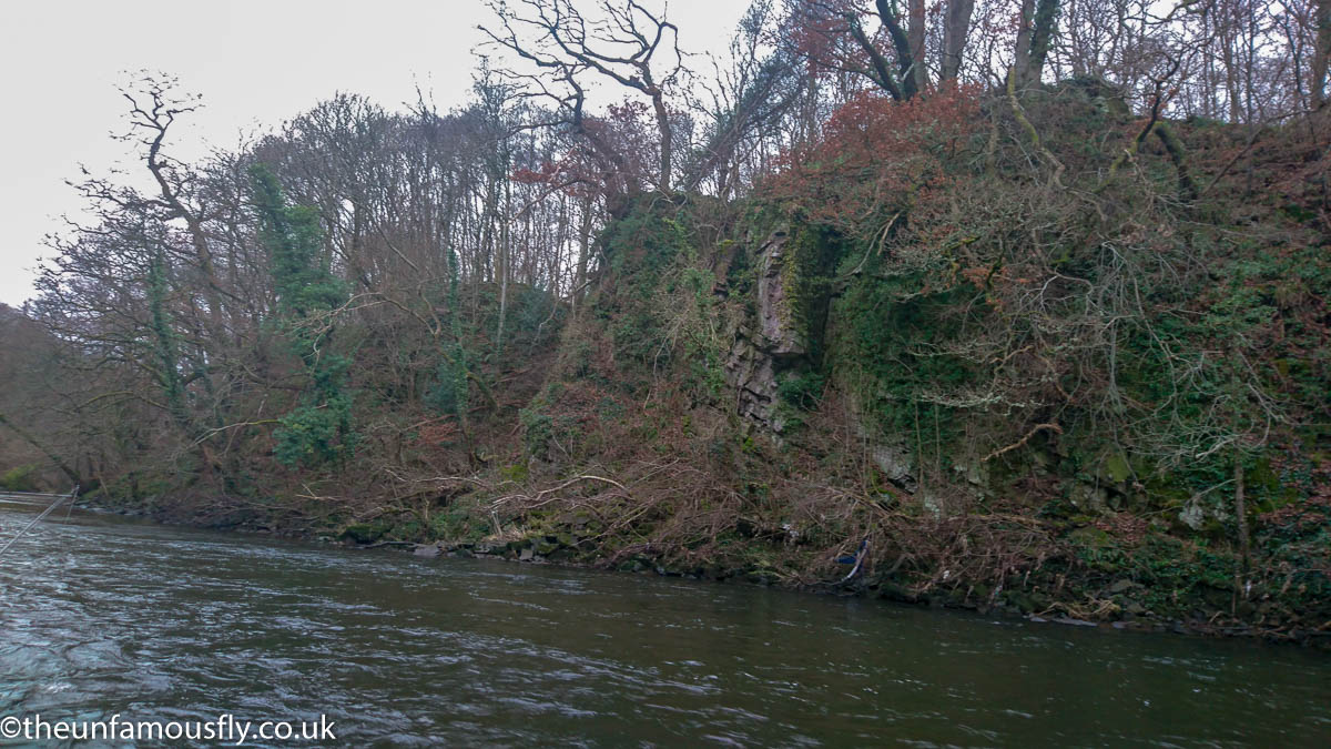
Let’s Fly the Clyde: Hazelbank South
Crossford
Crossford is another popular Clyde Valley spot, not least because you can get parked close to the river. Access is from the road heading out of Crossford about half way down the High Street. which crosses a stone bridge. Just over the bridge take the turning on the right. You used to be able to pass through the gate here and park along this wooded road, however in recent years the gate has been locked shut. Maybe one day it will reopen. I think it used to go to a small trading estate. You can with care park at this gate but be aware it is also an access road for local (well heeled) residents, so don’t block the road.

Above the bridge I regard as two sections. Nearest the bridge for about 200 yards or so you have lots of fishable water. In places the wading is hard, if the water is any height at all take a wading stick. The river is pretty wide here too so to cover further out you need to wade out in the flow. It is though a productive stretch for Brown Trout and Grayling.
If you head still further upstream there is a rather decrepit old footbridge. Cross it at your own risk but in so doing it opens up nice pools below and some pocket water above. All is worth exploring.

Downstream from the stone bridge is a nice run of both pocket water and of a more steady depth and where I find at least the wading is easier. You will come to a small burn inlet witha wooden footbridge, there is a gravel section here that slopes into a deep hole. On its day it can fish well but it can also be frustrating. You can then head on downstream along the Clyde walkway and there are some sections to fish down here though again the wading can be challenging with big round boulders in places.
Mauldslie
Anglers usually park at the Bridge on the entrance to Mauldslie Estate, Mauldslie Bridge. This is a popular area not only with anglers but dog walkers especially at weekends.
Currently ( Feb 2019) the bridge is blocked to vehicular traffic due to some sort of works. I
Nonetheless, this is a nice section both above and below the bridge. Above the
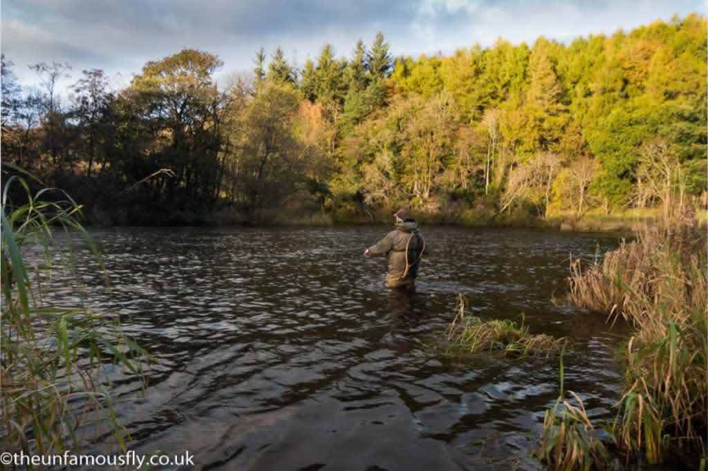
Below the bridge it is the other way round, the water is generally fished from the bank furthest from the road where the Clydeside walkway runs.
Whle the wading is generally easy just watch your depth in paces where it can slope off quite quickly and you might struggle to wade back against the current. This is also a popular area with Salmon anglers and Salmon Redds are to be found here so watch where you wade.
Dalserf
Garrion Bridges
This is quite a large section of the lower part of the Upper Clyde. In what is considered to be the bottom end of the Clyde Valley ( for fishing purposes at least) there are a few areas either side of the double bridges and roundabout at Garrion Bridge.
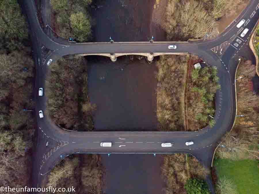
On the North side you can access the river down a side road just before the Garrion bridge roundabout, maybe about 500meters before?
Down this road you will come to some fancy modern houses and there is a UCAPA sign on a gate, through which there is space for a couple of cars in a cutting. Please be civil to residents who also use these spaces, and be cognizant you are behind peoples homes.
The river is accessed over what appears to be some derelict but unused land maybe from a prior industrial use. There are a set of wooden steps taking you to the river bank. This is a popular salmon pool in season so trout and grayling anglers may need to give way.
The river here is very deep in all but low water conditions, in the lowest conditions you can probably wade about 1/3 out from the bank at most, with deep water being mid-channel. Downstream is slower and les sinviting for the Trout angler, heading upstream though you can get further across the river if you initially keep close to the bank until past some overhanging bushes, where the river thins out and it is possible to almost wade right across the river. At this point the Lower Garrion bridge is in sight. The water above this point looks thinpocket water but might be worth a go in summer if there is decent water in the river.
Parking around the Garrion Bridges would be difficult unless a resident.

Above the bridge I am not 100% of the access, certainly there is a layby on the right hand side as you head south off the Garrion bridge Roundabout. By crossing the road here you can see a steep bank through woods to the river side, I have not tried it though to say if it is accessible. If it is, you may need to be fearless or a mountain goat.






Hi
Thanks for your critique – which is very fair – we are working on a decent map – this is the first website I’ve been involved in & there maybe a bit to much enthusiasm in it.
What I would like to say is that our Rearing Ponds & Hatchery is a completly unique project & currently no,other Anglimg Clubs we know of run such a facility & you would be welcome to come and visit our set up to view it for yourself.
We will put a link to your pages on our website.
Best regards
Hi Alan-
thanks for dropping by- would love to come and see and also try out the fishing sometime. I can help you with the menu thing on your site- I will email separately, but don’t hold back on the website- enthusiasm is what so many angling sites lack- and yours is one of the best I have seen for a club!
Keep up the good work.
Kenny
Hi Kenny
Site now updated in line with your comments – which we at the UAAA are thankful for – any other comments or ideas gratefully accepted – cheers – Alan
You are very welcome- anything I can do to help or you find you are stuck with just ask- it never hurts! All the very best, will try get down that way sometime over the next season.
cheers
Kenny
I have updated the info on the site here in line with your efforts- top work Alan!
Nice blog, i was also on the Annan last weekend but i never got a fish over a pound. Tight lines for 2012.
You too mate! Another place I need to visit- http://www.anglersholidaycottages.co.uk/
You are welcome any time, 6lb minimum breaking strain. 😉
The Clyde is under rated in my opinion recently over the 2 yrs I have dabbled on various locations of the mid Clyde and have more often than not hooked into a trout or two,half pound to three quarter small maybe but proof the water is running clean and providing healthy stock for future fishing. On my last trip hooked a decent barbel between. Two half pounds may even up to the three pound mark trotting a worm and seeing what I guess to have been five or six pound rainbow leap out the water only three feet away from me. 20quid a season, I will be purchasing one for next season
If you were on mid Clyde more than likely a Grilse than a Rainbow, no?
hi i just got new permit at strathclyde park can i fish in the river beside strathclyde park
I wouldn’t think so, the River beside Strathclyde Park is the Clyde, I think thats UCAPA water so you would need a one of the various UCAPA permits.
Can anyone tell me any good spots for trout in the Clyde I have tried car stairs and never touched a fish
There are fish all over the river it’s just getting the right method/fly on the day! Sorry your not having luck. Mauldslie, Crossford, Hozier and Abington are all popular spots.
I see you commented on Abington as popular spots on the clyde, I have recently retired and thought of giving Abington a try! I went there for two days (3rd to 4th May 2016) and stayed in the Abington Hotel. I fished it for the two days and never had any luck, Then to my horror on my way back to Glasgow by public transport I struck up a conversations with locals, they told me that fishing this stretch of water is no longer viable due to the fact that the water is infested with the North American Crayfish. This has been documented since early 2000 on the internet and two barriers have been built at a cost of £50.000. I am going to contact South Lanark Council regarding this to find out what the exact situation is regarding the River Clyde in the South Lanark Area.
Someone is winding you up. Someone caught a 4lb Brown at Crawford yesterday, and the Scottish National Fly Fishing League holds its competition on this stretch tomorrow. Plenty fish up there. I have blanked a few times but also had some nice fish. Yeah there are Crayfish but they are through the entire system now. Just need to find the fish and the method.
Thank’s for your reply, I will give it another go in the next week or two. I take it your talking about the stretch from the Abington bridge up stream toward Crawford. I think I’ll start from Crawford and work my way down next time. Thanks again for the info.
I don’t know the EXACT spot the fish was caught yesterday, it was on the river clyde group on facebook. It stated Crawford. My friends who fish the Clyde a lot more than me fish up there all the time. Another few spots to try are down from Telford Bridge above Crawford, The Monument ( at Abington),( Abington gets very busy lots of people fish there so it’s fairly pressured) Mauldslie Bridge can be good, Crossford, and the Hosier section can be good on its day at this time of year with the Yellow May Duns coming off.( it is hard wading in places around the Clyde Shoals.) Above Telford Bridge towards Elvanfoot I have had less luck there, this is the area where the Crayfish were boxed in for a long time until they spilled out. However I know people that only fish up that way. Its very fishy water but these are clever fish as they see a lot of flies and bugs. Tight lines.
I’m going to give it a whirl on Monday May 9th. I have a senior citizens UCAPA season permit for Abington, do you know if this is also ok for Crawford. I’ll tie some of Davie McPhail’s patterns for Yellow May and emerger patterns the week-end. Thank you very much.
Yeah should be fine. You can fish all the way up to Daer water I think.There are a few no go spots on some farms that UCAPA dont have the rights though I suspect no one will bother you in the main, just wee bits.